Hurricane Ian’s forecast track centers on Manatee. That means powerful wind, storm surge

READ MORE
Hurricane Ian’s impact on Manatee County
Get the latest info on Hurricane Ian’s effects in in Bradenton, Manatee and Sarasota County.
Expand All
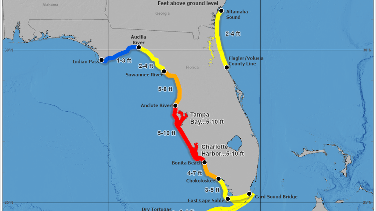
Manatee County is forecast to feel Hurricane Ian’s strong winds flooding rain and life-threatening storm surge of up to 10 feet as the Category 3 storm treks toward a landfall south of the Tampa Bay area.
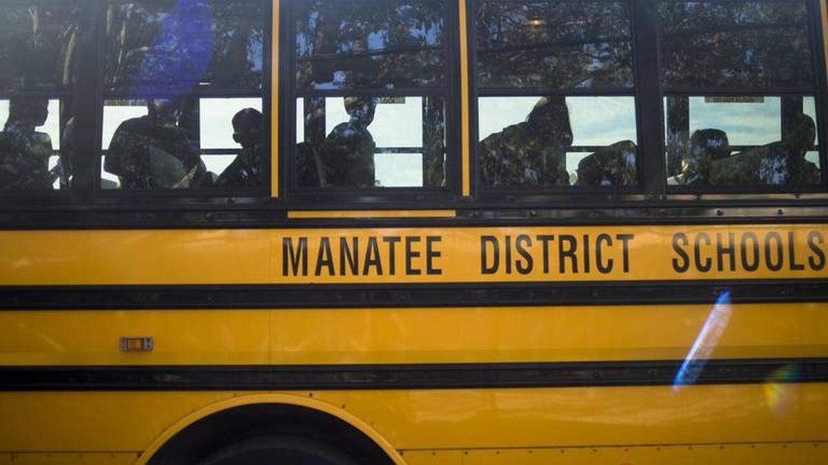
The National Weather Service in Tampa Bay expects Manatee County, which is under a hurricane and storm surge warning and has begun mandatory evacuations, will start to feel hurricane conditions Wednesday night through Thursday, with conditions likely to start improving late Thursday or Friday.
Manatee County could feel hurricane-force winds well over 100 mph, flooding rain and possible storm surge of 7 to 10 feet, according to the weather service.
Inland Manatee County, such as Parrish, Lakewood Ranch and Myakka City, could see peak winds of 80-100 mph with gusts up to 125 mph while coastal areas, such as Bradenton and Anna Maria Island, could see peak winds of 65-85 mph with gusts to 105 mph, according to the weather service “Threats and Impacts” web page.
The stronger winds are Cat 2 strength (96-110 mph) though the weather service notes that it’s possible Manatee might see winds that are Cat 3 strength (up to 129), depending on Ian’s track and strength.
Floridians are “starting to run out of time” to prepare for Ian’s arrival. warned Jamie Rhome, acting director of the National Hurricane Center, in a Tuesday morning broadcast.
“If you’re ordered to go you really should do so,” he said. “It’s really important that people start taking this seriously.”
Manatee is also under a flood watch through at least Thursday night, with the weather service predicting 5 to 10 inches of rain, with some isolated areas possibly seeing up to 18 inches. This could lead to moderate flooding, particularly in low-lying areas, due to the ground already being saturated from summer rain. There’s also a risk for isolated tornadoes.
Rhome warned that Ian’s rains will arrive long before the winds will, which could lead to significant flooding risk long before Hurricane Ian’s center nears the coast.
“A typical summertime thunderstorm here in Florida would put down 1 inch. Multiple that by 10 or 15,” he said.

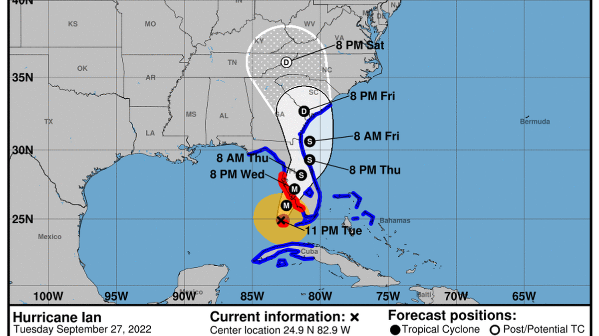
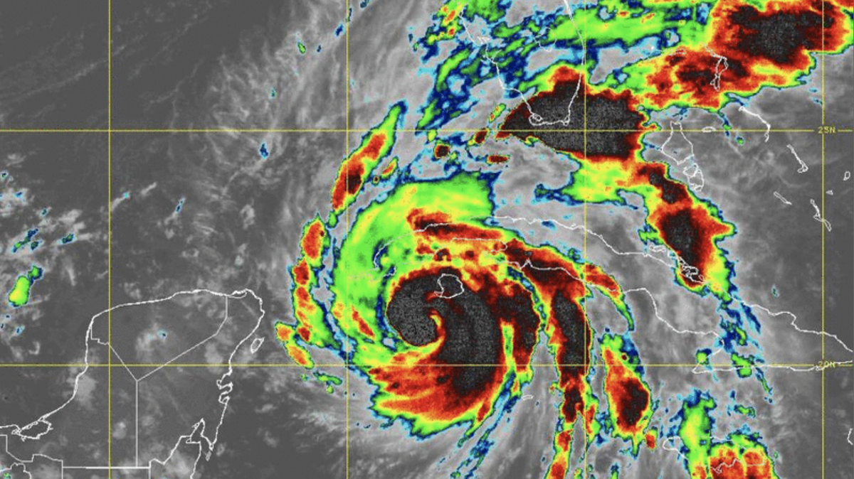
On the forecast track, Ian made landfall in western Cuba as a Cat 3 with maximum sustained winds of 125 mph early Tuesday. It’s now in the Gulf of Mexico, where conditions are ripe for it to strengthen into a Category 4 hurricane as it heads to Florida’s Gulf Coast.
The National Hurricane Center expects vertical wind shear and drier mid-level air will weaken Ian back into a Cat 3, though it’s also expected to slow down, which is bad news for Florida. A slower Ian means Florida’s west coast will feel more of its life-threatening storm surge, wind and heavy rain.
Ian’s projected path shifted slightly Tuesday, with the National Hurricane Center’s 11 a.m. update now pushing the storm to an earlier potential landfall south of the Tampa Bay area. Ian is now expected to be a Cat 3 hurricane by the time it’s offshore of Sarasota, with a potential landfall near Venice late Wednesday night.

Miami Herald staff writer Alex Harris contributed to this report.
This story was originally published September 27, 2022 at 6:41 AM.