Manatee is under a tropical storm warning. When will we feel Elsa’s strongest effects?
As Tropical Storm Elsa crosses Cuba, Manatee County and much of the Florida Gulf Coast are under a tropical storm warning.
When will we know that Elsa has arrived?
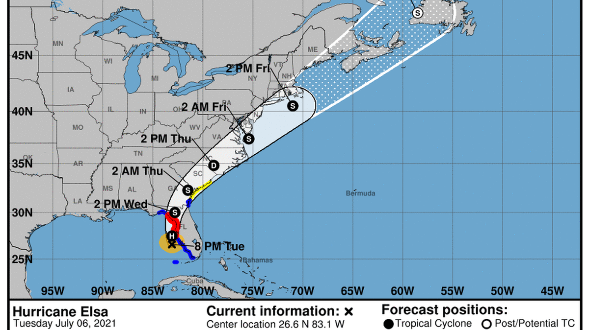
As of 11 p.m Tuesday, Elsa was about 65 miles southwest miles of Tampa and 125 miles south of Cedar Key, with sustained winds of 75 mph, the threshold to be considered a category 1 hurricane. It was moving to the north at 14 mph, according to the National Hurricane Center.
In the next 24 hours, the hurricane center predicted Elsa could reach near-hurricane strength with 70 mph sustained winds, which prompted hurricane watches for the west-central coast and Big Bend region of Florida.
Manatee County remained under tropical storm and storm surge warnings.
The storm was expected to make landfall at Horseshoe Beach, north of the Suwannee River, but before then Manatee County residents will know she is in the neighborhood and should prepare for a stormy day Tuesday.
The National Weather Service on Monday afternoon said the window for strong winds for Manatee County is Tuesday afternoon through early Wednesday morning. Forecasters said winds on Tuesday afternoon could hit 23 mph, with gusts of up to 32 mph by 3 p.m.
By midnight, winds in Bradenton should hit a maximum of 34 mph, with gusts of up to 41 mph.
On Anna Maria Island, winds could hit 56 mph by midnight; in Lakewood Ranch and Parrish, 34 and 37 mph, respectively.
“Plan for dangerous wind of equivalent strong tropical storm force, the Weather Service said. “Remaining efforts to protect life and property should be completed as soon as possible. Prepare for significant wind damage.”
As for rainfall, the Weather Service said to expect between 3 and 6 inches from Elsa, with some areas getting more. Manatee County remains under a flood watch until 4 a.m. Wednesday.
Mantee also is under a storm surge watch. Elsa could bring a surge of up to 2 feet in surge prone areas between Tuesday morning and Thursday evening, according to the Weather Service.
Gov. Ron DeSantis warned Floridians to stay vigilant Tuesday morning as Tropical Storm Elsa approached the state’s west coast.
DeSantis said Elsa will be carrying near-hurricane strength winds when it made landfall overnight Tuesday. He did not expect any major changes to the storm’s track, which currently shows the storm making its way up the west coast on Wednesday.
Most of the heavy rainfall will be east of the center of the storm, he said.
“It’s incredibly lopsided to the east,” DeSantis said.
Parts of north and central Florida, which have received above-average rainfall in recent weeks, could see flash flooding, he said.
“You’re going to see a lot of rain dumped, particularly in the northern part of the state, that is already saturated right now,” DeSantis said. “You will see flash flooding conditions in many parts of Florida.”
The state’s Emergency Operations Center in Tallahassee has been activated to level 1, the highest level. Typically, the center would not be under level 1 for a tropical storm, but it’s been upgraded to help smaller counties that may not be equipped to handle the storm’s impact, DeSantis said. A small team of emergency officials are still in Surfside, where rescuers are still searching for victims from the collapse of a 12-story oceanfront condo.
Herald/Times Tallahassee staff writer Lawrence Mower contributed to this story.
This story was originally published July 5, 2021 at 2:00 PM.